

 George B. Salter Memorial Grove
Warwick, RI Department of Environmental Management

0.3 miles of trail at this site are wheelchair and stroller-friendly, however, these trails may not meet ADA standards.
Duck hunting is permitted in season only on Rock Island, which should not be visited then by people not engaged in hunting.
Click on the "Trail Map (PDF)" button to download a PDF of the trail map that you can print and take with you on the trail.
Avenza maps are special, free maps that you can use in the Avenza app on your smart phone. These maps let you see your location on the map as you walk. Download the Avenza App for free in the Apple App Store or on Google Play
Click on the Avenza Trail Map button to "purchase" the free map for this trail from the Avenza map store. If this is your first time, Avenza will ask you to set up an account to check out. However, all Avenza trail maps listed on ExploreRI are free.
In Rhode Island the primary hunting seasons typically run from the second Saturday in September to the last day of February and from the third Saturday in April to the last day in May, however this can vary from year to year and depends on what game is being hunted. During hunting season you should wear at least 200 square inches (a hat OR a vest) of blaze orange. During shotgun deer season, which is typically in December, you should wear at least 500 square inches of blaze orange (a hat AND a vest). For more information see the RI DEM website.
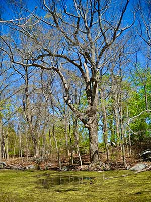
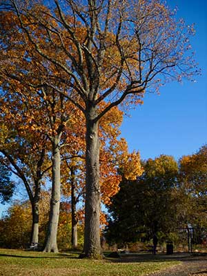
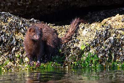
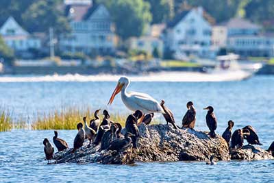


Salter Grove, a small suburban park overlooking the Providence River, is a great place to start exploring nature in Rhode Island, especially for students and families. Novice naturalists can conveniently learn the 155 bird and 300+ plant species observed there and then apply the knowledge elsewhere in Rhode Island and beyond.
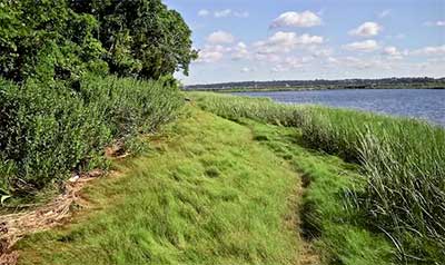
On the mainland portion of the park, four short, well maintained trails (total 0.7 mi) traverse and connect diverse habitats including lawns, woodland, vernal pond, and salt marsh (detailed trail descriptions are available on the Guide to Salter Grove website). Walk south to their trailheads from three totem posts on the edge of the parking lot.
Woody plants, such as American elm, black gum, black cherry, black oak, dawn redwood, green ash, tree-of-heaven, and tulip tree along the trails are discretely labeled with black markers.
At observation stations, gold markers with QR-codes provide links to ecological, geological, and historical information from the Guide to Salter Grove. This is a smart phone-accessible and interactive website dedicated to helping visitors identify plants and birds while they are in the park.
Tapping the Sightings button in the Guide leads to a gallery of the birds or flowering and fruiting plants a visitor can expect to see for the day. Tapping on a mugshot will lead to more photos and life history information for each species. Curious visitors, parents, and teachers can explore the Guide to Salter Grove website in greater depth at home on their computer to prepare an education visit for their young charges.
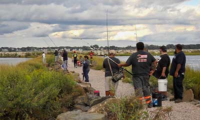
A causeway connects the mainland to the breakwater and both provide lovely views of the Providence River and wintering waterfowl. Fishermen flock to the breakwater when schools of bait fish lure game fish up the river. Except for periods of very high tide, it is possible to walk safely out to Rock Island.
Salter Grove is not just for learning about plants and wildlife. It is also a favorite destination for families with young children throughout the year because of its beautiful playground set among greenery. Audubon Hill at its south end has traditionally been a favorite for sledding after a good snowfall.
Note that contrary to usual mapping conventions, north is down on the trail map.
Friends of Salter Grove website
Dogs: Dogs must be leashed and picked up after at ALL times.
Bicycles: Salter Grove is bike-accessible, but bikes are not permitted off of paved surfaces.
Other Amenities: There is Portapotty (in season), picnic tables, bicycle rack, and playground. Fishing is possible from causeway and breakwater.

Salter Grove Parking Lot Trailhead
Driving Landmarks: The entrance to the park is on Narragansett Parkway, about a mile south of Pawtuxet Village. All of the trailheads are a short walk from the parking lot.
Parking: Yes: Parking lot, 20 spaces, no overnight parking
ADA Accessible Parking Spaces? Yes
Coordinates: 41° 45.197' N 71° 22.977' W See this location in: Google Maps Acme Maps
The RIPTA 4 bus stops on Narragansett Parkway, near Gillooly Drive, a few hundred feet from the entrance to the park.
KEY:
Trailhead
Only trailheads related to this trail system are shown on this map. To see all trailheads go to the main map.
Do you have comments, corrections or additions to the information about this site?
Help us work together to make this website better by sharing your knowledge!

Private feedback goes to the Blueways Alliance/RI Land Trust Council. We'll use your information to make this website better or pass it along to the people who can deal with physical issues at this site. Public comments are posted here (once they've been reviewed and approved) for all to see.
The data on this website come from many sources, including volunteers and organizations across the state of Rhode Island and nearby parts of Massachusetts. We have done our best to make sure the data are accurate and up to date, but any information critical to the success of your trip should be confirmed before you start. The maps and information on this website should not be substituted for topographic maps or other more detailed maps and guides. We welcome corrections and additions. To send a correction or provide other feedback, please use our feedback form (see link above).
This site report was last updated on March 29, 2024