

 George B. Parker Woodland Wildlife Refuge
Coventry, Audubon Society of Rhode Island

![]() 5.0 miles of trail
5.0 miles of trail
Moderate
Click on the "Trail Map (PDF)" button to download a PDF of the trail map that you can print and take with you on the trail.
Avenza maps are special, free maps that you can use in the Avenza app on your smart phone. These maps let you see your location on the map as you walk. Download the Avenza App for free in the Apple App Store or on Google Play
Click on the Avenza Trail Map button to "purchase" the free map for this trail from the Avenza map store. If this is your first time, Avenza will ask you to set up an account to check out. However, all Avenza trail maps listed on ExploreRI are free.
In Rhode Island the primary hunting seasons typically run from the second Saturday in September to the last day of February and from the third Saturday in April to the last day in May, however this can vary from year to year and depends on what game is being hunted. During hunting season you should wear at least 200 square inches (a hat OR a vest) of blaze orange. During shotgun deer season, which is typically in December, you should wear at least 500 square inches of blaze orange (a hat AND a vest). For more information see the RI DEM website.
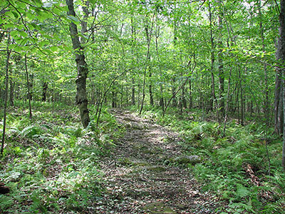

George B. Parker Woodland Wildlife Refuge is a magical place of ancient rock formations, Revolutionary War-era carriage roads, great wildlife watching and strenuous exercise on 860 acres of mostly forested land. The property consisting of majestic old forest, brooks, fields, and mysterious rock cairns. The caretaker's house was built in the 1700s. The barn has been converted into a nature center.

Parking Lot 1 Trailhead
Driving Landmarks: From I-95 north or south take exit 5B for Route 102 north. Follow Route 102 north for about 8.5 miles. Turn right (east) onto Maple Valley Road (across 102 on the left is Waterman Hill Road). Turn into the second driveway on the left, at the Parker Woodland Wildlife Refuge sign.
Parking: Yes: Parking lot, no overnight parking
ADA Accessible Parking Spaces? No
Coordinates: 41° 43.009' N 71° 41.877' W See this location in: Google Maps Acme Maps
Parking Lot 2 Trailhead
Driving Landmarks: From I-95 north or south take exit 5B for Route 102 north. Follow Route 102 north for about 8.5 miles. Turn right (east) onto Maple Valley Road (across 102 on the left is Waterman Hill Road). Go past the first parking area, (the second drive on the left, where there's a Parker Woodland Wildlife Refuge sign) and continue for another 1/2 mile to where there is a small gravel parking area on the left, at the second trailhead.
Parking: Yes: Parking lot, no overnight parking
ADA Accessible Parking Spaces? No
Coordinates: 41° 43.142' N 71° 41.454' W See this location in: Google Maps Acme Maps
KEY:
Trailhead
Only trailheads related to this trail system are shown on this map. To see all trailheads go to the main map.
Do you have comments, corrections or additions to the information about this site?
Help us work together to make this website better by sharing your knowledge!

Private feedback goes to the Blueways Alliance/RI Land Trust Council. We'll use your information to make this website better or pass it along to the people who can deal with physical issues at this site. Public comments are posted here (once they've been reviewed and approved) for all to see.
The data on this website come from many sources, including volunteers and organizations across the state of Rhode Island and nearby parts of Massachusetts. We have done our best to make sure the data are accurate and up to date, but any information critical to the success of your trip should be confirmed before you start. The maps and information on this website should not be substituted for topographic maps or other more detailed maps and guides. We welcome corrections and additions. To send a correction or provide other feedback, please use our feedback form (see link above).
This site report was last updated on April 26, 2021