

 Perry Tavares Farm Conservation Land
Bristol, Town of Bristol

![]() 2.0 miles of trail
2.0 miles of trail
Moderate
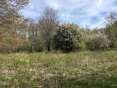
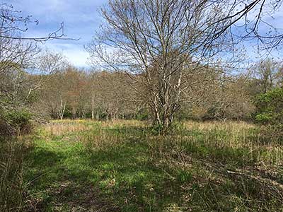
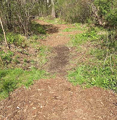
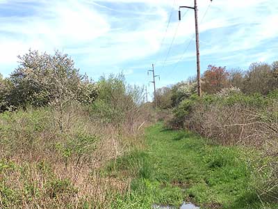
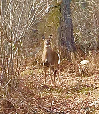


The nearly two mile system is blazed with blue, white, and yellow trails. There are several access points to the property including the Elmwood Drive entrance which features a footbridge over a small stream. The property is rich with old stone walls, vernal pools, and old towering oaks and maples. The blue blazed trail runs from Metacom Avenue westerly to the power line easement and the yellow loop trail. The yellow trail loops through the midsection of the property passing areas of birch trees, a cedar grove, and small outcrops of pudding-stone. The white blazed trail at the northern end of the property weaves along the edge of a meadow and through areas of thickets that are a haven for birds. The property is especially suited for photography of flowers and birds. The property has had a wildlife survey done, and is home to rabbits, toads, robins, blue jays, woodpeckers, finches as well as an abundance of wildflowers
Description of the trail on the Trails and Walks RI website (scroll down)
Dogs: On leash, clean up after pet.
Horses: Not at this time
Bicycles: Yes. Yield to walkers, stay on marked trails.

Footbridge at Elmwood Drive Trailhead
Driving Landmarks: End of Elmwood Dr, off Hope Street (Rt. 114), across from Audubon Education Center in Bristol
Parking: Yes: On street, 6 spaces, no overnight parking
Coordinates: 41° 42.672' N 71° 16.55' W See this location in: Google Maps Acme Maps
End of Jameson Drive Trailhead
Driving Landmarks: End of Jameson Dr, off Metacom Ave (Rt. 136) at Warren line
Parking: Yes: On street, 6 spaces, no overnight parking
Coordinates: 41° 42.722' N 71° 16.297' W See this location in: Google Maps Acme Maps
San Francisco Street Trailhead
Driving Landmarks: This trailhead is at the end of San Francisco Street. This is a short street off of Metacom Avenue (Route 136). There's a small gravel parking lot with space for 4-5 cars, plus on-street parking.
Parking: No
Coordinates: 41° 42.484' N 71° 16.125' W See this location in: Google Maps Acme Maps
Yes. RIPTA Bus 60 on Hope Street (Rt. 114) at Elmwood Drive or RIPTA Bus 61X on Metacom Avenue (Rt.136).
East of East Bay Bike Path. Exit path at Campbell St. in Warren, follow Hope St. south to Elmwood Dr. trailhead (approx. 1 mile)
KEY:
Trailhead
Only trailheads related to this trail system are shown on this map. To see all trailheads go to the main map.
Do you have comments, corrections or additions to the information about this site?
Help us work together to make this website better by sharing your knowledge!


Private feedback goes to the Blueways Alliance/RI Land Trust Council. We'll use your information to make this website better or pass it along to the people who can deal with physical issues at this site. Public comments are posted here (once they've been reviewed and approved) for all to see.
The data on this website come from many sources, including volunteers and organizations across the state of Rhode Island and nearby parts of Massachusetts. We have done our best to make sure the data are accurate and up to date, but any information critical to the success of your trip should be confirmed before you start. The maps and information on this website should not be substituted for topographic maps or other more detailed maps and guides. We welcome corrections and additions. To send a correction or provide other feedback, please use our feedback form (see link above).
This site report was last updated on December 13, 2022
Comments:
Dangerous Due to Hunting
Submitted by: Anonymous; October 13, 2023; 9:44 pm
Hunters have taken over. No longer safe. Grisly and frequent infractions. Wearing orange is not enough to ensure safe passage, let alone enjoyable hiking.
Rating:
Overgrown and unmaintained
Submitted by: T; August 15, 2023; 3:28 pm
Trails are not maintained and are hard to locate.
fatima drive parking closed
Submitted by: Ronnie ; November 4, 2022; 1:56 pm
As of October 2022 The parking area at the intersection of metacom ave and fatima drive is closed and blocked off with large boulders. The sign posting this hiking area has been removed.