

 Bold Point Park
41° 48.928' N 71° 23.431' W See this location in: Google Maps Map Server Acme Maps
This is a site for launching boats from trailers. Boat ramps can normally be used to launch canoes and kayaks but please do your best to keep the boat ramp clear for boat trailers.
Description & Overview:

There is a two-lane concrete boat ramp here in OK condition, with a handicapped accessible dock in-between the two lanes of the ramp.
Bold Point Park used to be rather scruffy but it's been updated in recent years and should now be in better condition.
WARNING: Years ago many ships were abandoned around Bold Point. What look like old pilings in the water are the remains of these old ships. Most do not present much risk to kayaks but they could easily damage larger boats.
Bold Point Park provides access to the Providence and Seekonk Rivers. Heading north and east from the site takes you through the narrows into the Seekonk, but be prepared for strong tidal currents through the narrows!
Heading west and south from the site takes you down the Providence River. Keep a sharp eye out for commercial vessels and stay well clear of them and the docks they use. Port security will not look kindly on small boats poking in amongst the commercial docks and small boats should give LOTS of space to commercial vessels that are underway.
You can also cross over to India Point and follow the shoreline of India Point Park west around India Point and up the Providence River (through the hurricane barrier). As long as you stay close to shore, this route keeps you clear of most, but not all of the areas used by commercial vessels.
This put-in is on the Roger Williams Trail that traces the route Roger Williams and his followers took in 1636 when they paddled by canoe from what is now East Providence to Providence, to settle and found what would become the state of Rhode Island.
This site provides access to the following water bodies: Providence River, Seekonk River.
Location:
Town: East Providence
Driving Landmarks: Heading EAST on I-195 take exit 4. Merge onto Veterans Memorial Pkwy and then take an almost immediate right onto Mauran Avenue followed by a left onto Pier Road, which leads to the park.
Heading WEST on I-195 take take exit 6 in East Providence. Turn left under the highway and then turn right onto Warren Avenue. Go 0.7 miles and turn left on 1st Street. Go one block and turn right Mauran Avenue. Go two blocks and turn left onto Pier Road, which leads to the park.
Access & Waters:
Water 'Features' At Site: estuary
Note: Because one boat launch can access, say, both a lake and a river or both the upstream and downstream portions of a river, not all paddling trips at a given site will necessarily encounter all of the features listed.
Type of Access: Boat ramp
ADA Accessible Boat Launch? yes
Shoreline: There is a two-lane concrete boat ramp here and the adjacent shoreline is largely gravel, reasonably suitable for launching hand-carried boats.
Float/Dock: low float or dock
Parking:
Parking: yes: 35 spaces
ADA Accessible Parking Spaces? yes
Nearby Amenities:
Public Restrooms: No
Sources for More Information:
Website: Roger Williams Trail Map (PDF)
Ecological, Cultural & Recreational Attractions:
Bold Point Park is a pleasant but not very well-maintained 2-acre park with the waters of the Providence and Seekonk Rivers on three sides.
Photographs:
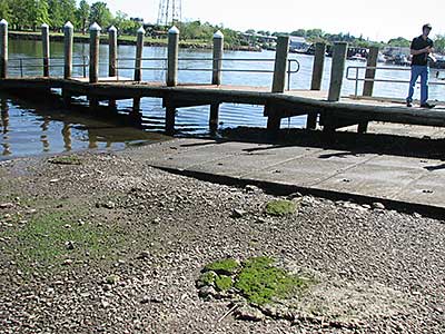
The Boat Ramps and Dock at Low Tide
Photography by: Bruce G. Hooke
Date of Photograph: May 21, 2014
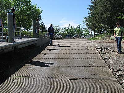
View up the Boat Ramp at Low Tide
Photography by: Bruce G. Hooke
Date of Photograph: May 21, 2014
The second ramp is to the left of the dock.
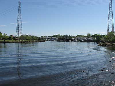
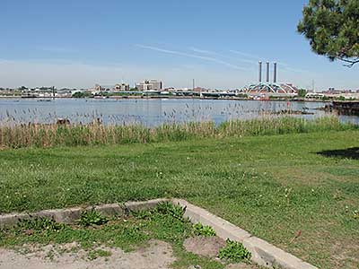
View up the Seekonk River from the Boat Ramp
Photography by: Bruce G. Hooke
Date of Photograph: May 21, 2014
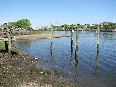
View South from the Boat Ramp
Photography by: Bruce G. Hooke
Date of Photograph: May 21, 2014
This view is at low tide. The remains of the former dock are in the foreground.
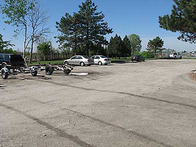
The Parking Lot at Bold Point Park
Photography by: Bruce G. Hooke
Date of Photograph: May 21, 2014
View Across the Providence River from Bold Point
Photography by: Bruce G. Hooke
Date of Photograph: May 21, 2014
The Interstate 195 "I-way" bridge is on the right, with the Dominion Energy power plant beyond.
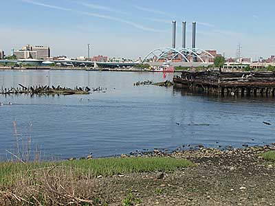
The Waters off Bold Point. Note all the abandoned ship remains.
Photography by: Bruce G. Hooke
Date of Photograph: May 21, 2014
This photograph was made near low tide so you can see some of the remains of the old ships abandoned around Bold Point. Many of these wreck remnants are underwater at high tide.
Do you have comments, corrections or additions to the information about this site?
Help us work together to make this website better by sharing your knowledge!

Private feedback goes to the Blueways Alliance/RI Land Trust Council. We'll use your information to make this website better or pass it along to the people who can deal with physical issues at this site. Public comments are posted here (once they've been reviewed and approved) for all to see.
The data on this website come from many sources, including volunteers and organizations across the state of Rhode Island and nearby parts of Massachusetts. We have done our best to make sure the data are accurate and up to date, but any information critical to the success of your trip should be confirmed before you start. The maps and information on this website should not be substituted for nautical charts, topographic maps, or other more detailed maps and guides. We welcome corrections and additions. To send a correction or provide other feedback, please use our feedback form (see link above).
This site report was last updated on July 13, 2020