

 Berkley Bridge Village Heritage Park
41° 50.068' N 71° 6.419' W See this location in: Google Maps Map Server Acme Maps
This is a site for launching hand-carried boats such as canoes or kayaks.
Description & Overview:

Berkley Bridge Village Heritage Park provides excellent access to the Taunton River for paddle-craft. While it is another 10 miles before the river gets to Fall River and flows into Mount Hope Bay, by the time it gets to Berkley Bridge the Taunton River is almost 500 feet wide, with broad salt marshes along the shore in many places. Tides, tidal currents and wind are all important factors in planning a trip on this part of the Taunton.
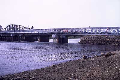
On an incoming tide it is quite possible to paddle the 4.1 miles upriver to Weir Village Park in Taunton and if you time the tides right you can then ride the outgoing tide back to Berkley Bridge. Going downriver from Berkley Bridge it will be easier if you have the tide going with you so an outgoing tide is recommended. It is 1.8 miles downriver to the next take-out at Dighton Rock State Park. Especially as you get close to Dighton Rock the river widens out and becomes even more bay-like and larger waves and stronger winds are possible and more motorboats are likely.
As you approach Dighton Rock State Park look for a small pier jutting out into the river from the left (east) bank with sloping stone sides and a small building on it. The best take out is just downriver of this pier. For more information see the listing for Dighton Rock State Park.
Click here for a printable map and guide (in Adobe Acrobat format) to paddling the Taunton River between Weir Village Park and Dighton Rock State Park.
This site provides access to the following water bodies in the Taunton River watershed: Taunton River.
Location:
Alternate Site Name: Berkley Bridge
Town: Berkley
Nearest Town Center: Dighton
Driving Landmarks: From the west (Dighton) side of the river take Center Street across the river and look for the park on your right just after you cross the bridge.
From the east (Berkley) side of the river take Elm Street to the river and look for the park on the left just before the bridge.
Access & Waters:
Water 'Features' At Site: estuary
Note: Because one boat launch can access, say, both a lake and a river or both the upstream and downstream portions of a river, not all paddling trips at a given site will necessarily encounter all of the features listed.
Type of Access: Boat launch for hand carried boats
ADA Accessible Boat Launch? no
Shoreline: A concrete walkway provides a solid walking surface down to the water. Otherwise the shoreline is a sand and gravel beach that turns to mud near the low tide line.
Float/Dock: no
Approximate Length of Carry between Car Access and Water: 125 feet
Parking:
Parking: yes: 10 spaces, no overnight parking
ADA Accessible Parking Spaces? yes
Nearby Amenities:
Public Restrooms: No
Sources for More Information:
AMC River Guide: 4th Edition, page 153
Website: Map and Guide to paddling the Taunton between Weir Village and Dighton Rock (Adobe Acrobat format)
Ecological, Cultural & Recreational Attractions:
Berkley Bridge Village Heritage Park is a small but neatly maintained park right by the east end of the bridge. There are picnic tables at the park and lovely views of the river, but no restrooms or drinking water.
Photographs:
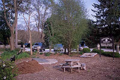
Berkley Bridge Village Heritage Park
Photography by: Bruce G. Hooke
Date of Photograph: May 1, 2010
The concrete walkway down to the water
Photography by: Bruce Hooke
Date of Photograph: April 7, 2022
Added since the earlier photograph below, from 2010.
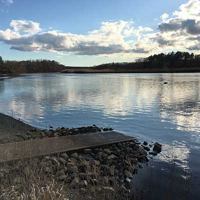
View Downriver from Berkely Bridge Park
Photography by: Bruce G. Hooke
Date of Photograph: May 1, 2010
The put-in/take-out is in the foreground. This photograph was made when the tide was low, but not as low as it sometimes gets here.
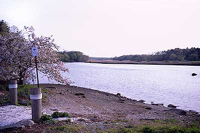
View Upriver from Berkley Bridge Park
Photography by: Bruce G. Hooke
Date of Photograph: May 1, 2010
The bridge from which this site takes its name. The put-in/take-out is in the foreground. This photograph was made when the tide was low, but not as low as it sometimes gets here.
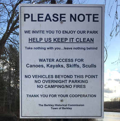
Sign at the park
Photography by: Bruce Hooke
Date of Photograph: April 7, 2022
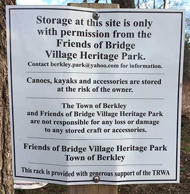
Sign at the park
Photography by: Bruce Hooke
Date of Photograph: April 7, 2022
There is a small boat storage rack at the park but as the sign says, advanced permission is required to store boats at the park.
Do you have comments, corrections or additions to the information about this site?
Help us work together to make this website better by sharing your knowledge!

Private feedback goes to the Blueways Alliance/RI Land Trust Council. We'll use your information to make this website better or pass it along to the people who can deal with physical issues at this site. Public comments are posted here (once they've been reviewed and approved) for all to see.
The data on this website come from many sources, including volunteers and organizations across the state of Rhode Island and nearby parts of Massachusetts. We have done our best to make sure the data are accurate and up to date, but any information critical to the success of your trip should be confirmed before you start. The maps and information on this website should not be substituted for nautical charts, topographic maps, or other more detailed maps and guides. We welcome corrections and additions. To send a correction or provide other feedback, please use our feedback form (see link above).
This site report was last updated on April 18, 2022