

 Hathaway Park Boat Ramp
41° 47.618' N 71° 4.358' W See this location in: Google Maps Map Server Acme Maps
This is a site for launching boats from trailers. Boat ramps can normally be used to launch canoes and kayaks but please do your best to keep the boat ramp clear for boat trailers.
Description & Overview:

Hathaway Park is 2 miles from the Taunton River on an arm of Shepherds Cove. Homes surround most of the cove, with private docks at many of the home, except for the northern part of the cove which is wooded. During the summer months, jellyfish can be seen swimming towards the Taunton River. There is a lot to explore in the cove for those who stay close to shore and this is a great location for leisurely trips.
Note that at low tide there is very little water at the end of the ramp, so only small boats needing less than 12" of water can be launched. There are also rocks around the base of the ramp that can create problems. At high tide there should be enough water to launch boats needing 18" to 30" of depth and the rocks should not be an issue for most boats.
If you are going south on the Taunton River and want to get to Shepherds Cover, the inlet will be on your left at Conspiracy Island, a tiny island south of Dighton Rock State Park. The beginning of the cove is small, less then 500 feet across, but it then opens up in an upside down U shape. Once in the cove, paddle towards the Route 24 overpass and you'll see Hathaway Park on your left shortly after.
If you are launching paddlecraft here please do your best to keep the boat ramp clear for boats that need to be launched from a trailer.
This site provides access to the following water bodies in the Taunton River watershed: Taunton River, Shepherds Cove.
Location:
Town: Assonet
Nearest Town Center: Assonet, MA
Driving Landmarks: Hathaway Park is located on Water Street in Assonet near the intersection with North Main Street and Elm Street (route 79). From route 24 north or south take exit 10 for North Main Street/Assonet/Dighton. Turn left at the end of the ramp onto North Main Street. Go approximately 0.8 miles and turn right at the stop sign onto Water Street. The park is 0.3 miles ahead on your left.
Boat ramp is next to a small basketball court and a circular turn around. You should unload your boats and gear and then park your vehicle clear of the boat ramp. There is a parking area along Water Street next to the park.
Access & Waters:
Water 'Features' At Site: estuary
Note: Because one boat launch can access, say, both a lake and a river or both the upstream and downstream portions of a river, not all paddling trips at a given site will necessarily encounter all of the features listed.
Type of Access: Boat ramp
Shoreline: Hard surface boat ramp with low bank adjacent to it.
Float/Dock: no
Parking:
Parking: yes: no overnight parking
Ecological, Cultural & Recreational Attractions:
Hathaway Park is a small city park with playing fields, a boat ramp, and views of the water.
Photographs:
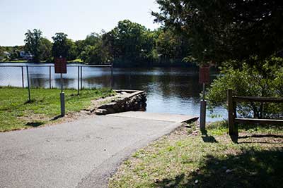
The Boat Ramp
Photography by: Bruce Hooke
Date of Photograph: September 15, 2022
The boat ramp as of 2022. A few bushes but otherwise it appears to be relatively unchanged.
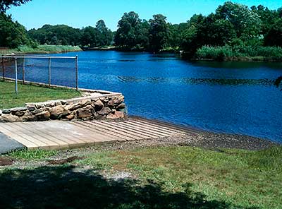
View of the Boat Ramp
Photography by: Adam Codega
View of the boat ramp and nearby shoreline. While the shoreline on one side of the ramp is fenced off the shoreline on the other side is low and open.
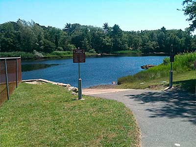
Another View of the Boat Ramp
Photography by: Adam Codega
Another view of the boat ramp and adjacent shoreline.
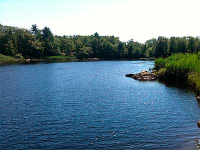
View Down River from the Boat Ramp
Photography by: Adam Codega
View "down river" from the boat ramp, towards the Route 24 bridge and ultimately the Taunton River.
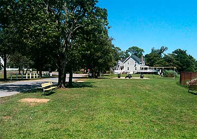
View Towards Water Street
Photography by: Adam Codega
View looking back towards Water Street from near the boat ramp.
Do you have comments, corrections or additions to the information about this site?
Help us work together to make this website better by sharing your knowledge!

Private feedback goes to the Blueways Alliance/RI Land Trust Council. We'll use your information to make this website better or pass it along to the people who can deal with physical issues at this site. Public comments are posted here (once they've been reviewed and approved) for all to see.
The data on this website come from many sources, including volunteers and organizations across the state of Rhode Island and nearby parts of Massachusetts. We have done our best to make sure the data are accurate and up to date, but any information critical to the success of your trip should be confirmed before you start. The maps and information on this website should not be substituted for nautical charts, topographic maps, or other more detailed maps and guides. We welcome corrections and additions. To send a correction or provide other feedback, please use our feedback form (see link above).
This site report was last updated on September 21, 2022